
Trialling koala habitat maps
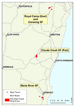
As part of the koala mapping program, the EPA trialled 3 different mapping approaches in areas of differing koala density and habitat, in Royal Camp, Carwong, Maria River and Clouds Creek state forests.
The project assessed the adequacy, cost effectiveness and efficiency of each approach for:
- identifying koala habitat
- producing management-scale maps to support the regulation of native forestry operations in public and private native forests.
The project mapped vegetation. Habitat classes based on likely proportion of koala feed trees were assessed.
Results
The project found that none of the mapping methods tested could produce an accurate, reliable and cost-effective map for managing koala populations and habitat in state forests. The validation exercises also demonstrated some limitations of using ground-based surveys to determine koala occupancy.
Results relating to koala use of habitat were:
- the quality of koala habitat does not restrict koala use, with koalas occupying areas beyond what is considered good habitat, albeit at lower densities
- variables including fire, past disturbance, roads, disease, predation and weeds influence koala occupancy in suitable habitat areas
- the influence of such variables is difficult to understand and map.
More details
Further detailed discussion and analysis of the project findings is contained in the project report Koala Habitat Mapping pilot (PDF 9.2MB)


